La diagonal de España is a project to cycle from the South West to the North East of Spain, from Sevilla to Donostia. A distance of about 1100 kilometers, to be done in about five days.
This was done in late October 2025, riding alone with a light bikepacking setup, staying in hotels along the way.
The idea
Ten years ago, I did my very first long-distance cycling trip, from Bruges to Arlon, in Belgium. This was about 400 kilometers I did in four days, and it was a great experience. I wrote about that trip here. Since then, I’ve been on and off the bike, and getting more intense since moving into the suburbs of Paris, where it’s more convenient to have a nice bike than in the city center.
My thirtieth birthday is in October, and I wanted to do something special for it. Of course at this time of the year, you can not be sure of the weather, but I figured that Spain would be a good destination to cycle to, as it’s generally warmer there than in France. This combined well with a good friend getting married in Sevilla just a little after, so I could start the trip from there.
Getting there
Going from Paris to Sevilla by train, to start the trip from there. This starts by taking the night train (intercités de nuit) from Paris Austerlitz to Cerbère, on the French-Spanish border. From there, a regional train (Rodalies de Catalunya) to Barcelona Sants, and then the Renfe high-speed train to Sevilla Santa Justa.
Note that the inter-Spain train does not accept complete bicycles, so they have to be disassembled and packed in a bike bag for that leg. There is a decent amount of space to keep the bike inside the carriage, but it’s best that you keep a look out at the intermediate stops to make sure no one accidentally walks into it.
We did this trip over two days, staying overnight in Barcelona to see a bit of the city, and to avoid a long day train immediately after a night train. In Barcelona I also did a ride to go up to Tibidabo and Montjuïc, two hills that offer great views of the city and the sea.
Extra Challenges
My partner gave me some extra challenges to do during the trip, to make it more interesting. These were:
- Learn a new phrase in Spanish
- Find a special 2€ coin
- Stroke a cat or a dog
- Try a new drink
- Make a detour to visit a site
- Eat a regional cheese
- Oh no - road closure
- Help someone
- Find a souvenir
- Eat a regional cheese
- Get someone to take a photo of me
- Find a city with a twin in Belgium
- Take a photo of a castle
- Eat a regional dish
- Learn a phrase in Basque
- Take a photo of something unexpected
- Cycle with someone
- Eat a regional dish
- Find a city with a twin in the UK
- Eat a regional dish
- Send a postcard
- Reach 10km of elevation
- Get a personal record
- Make an accidental wrong turn
- Find a city with a twin in France
- Fix a puncture
- Eat a regional cheese
- Overtake Abi
- Find an uncommon animal
- See the ocean
Day 1: Sevilla to Extremadura
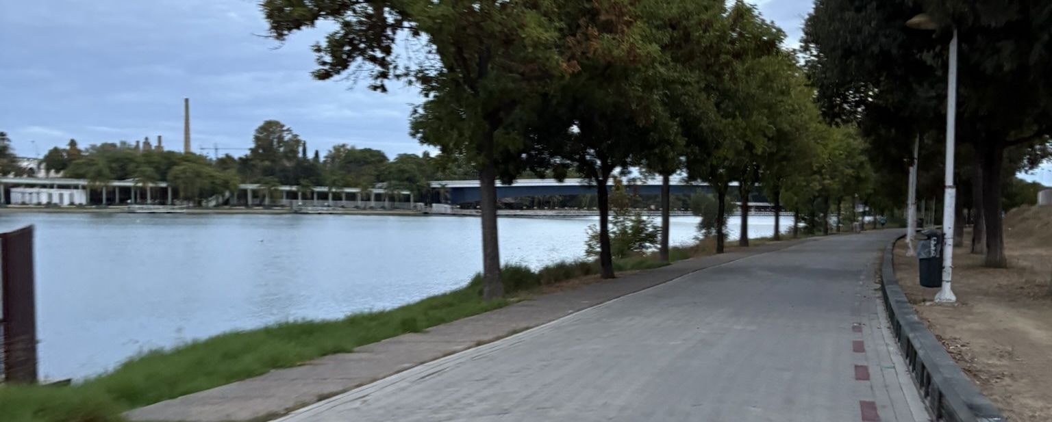
As it’s the first day, I’m excited and wake up before the sun even fully rises. After getting dressed and having some snacks, I get going in the empty narrow streets of Sevilla. It’s fairly warm for being early in the morning (around 16°C), which is a good start.
After the central area, I follow the Guadalquivir old river out of the city, passing by the early joggers and dog walkers. This part of the road is lined with concrete pavers, which isn’t totally ideal as they are a little loose, but at least they make a funny sound when I go over them.
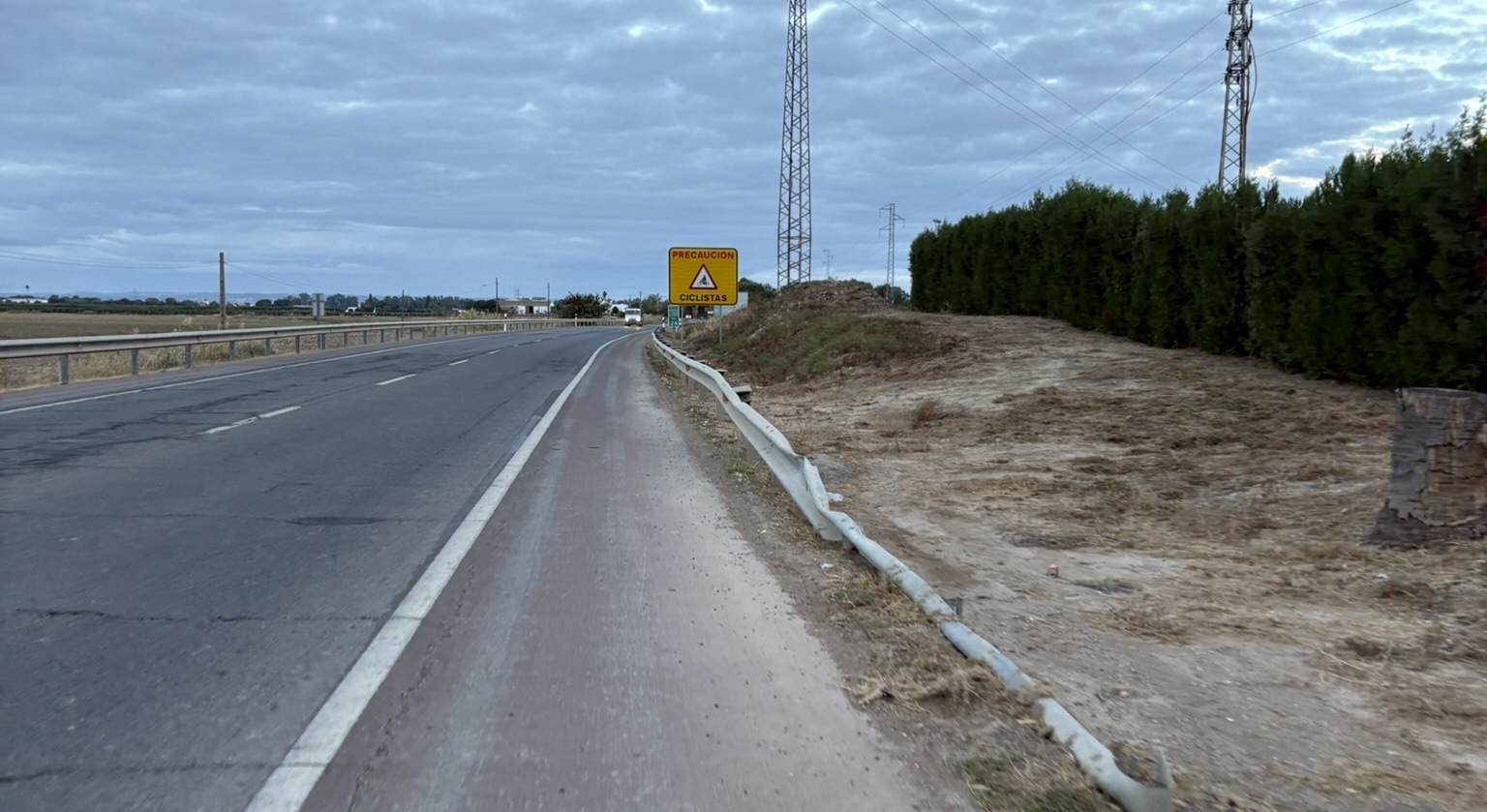
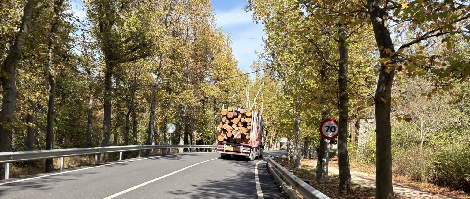
From then on I get to know what real Spanish roads look like: a fairly wide two lane road with a shoulder that’s roughly a meter wide. The traffic is very light, and those that I do cross are very respectful, usually passing in the other lane with plenty of space. The road surfaces are fine, but you need to keep your eyes open for the occasional pothole or part of broken asphalt.
I also spot here an unusual animal, a tiny green snake that crosses the road towards me! Of course I didn’t get a photo as I spent my energy yelping in surprise, but that was pretty impressive.
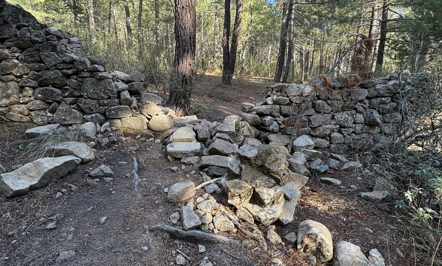
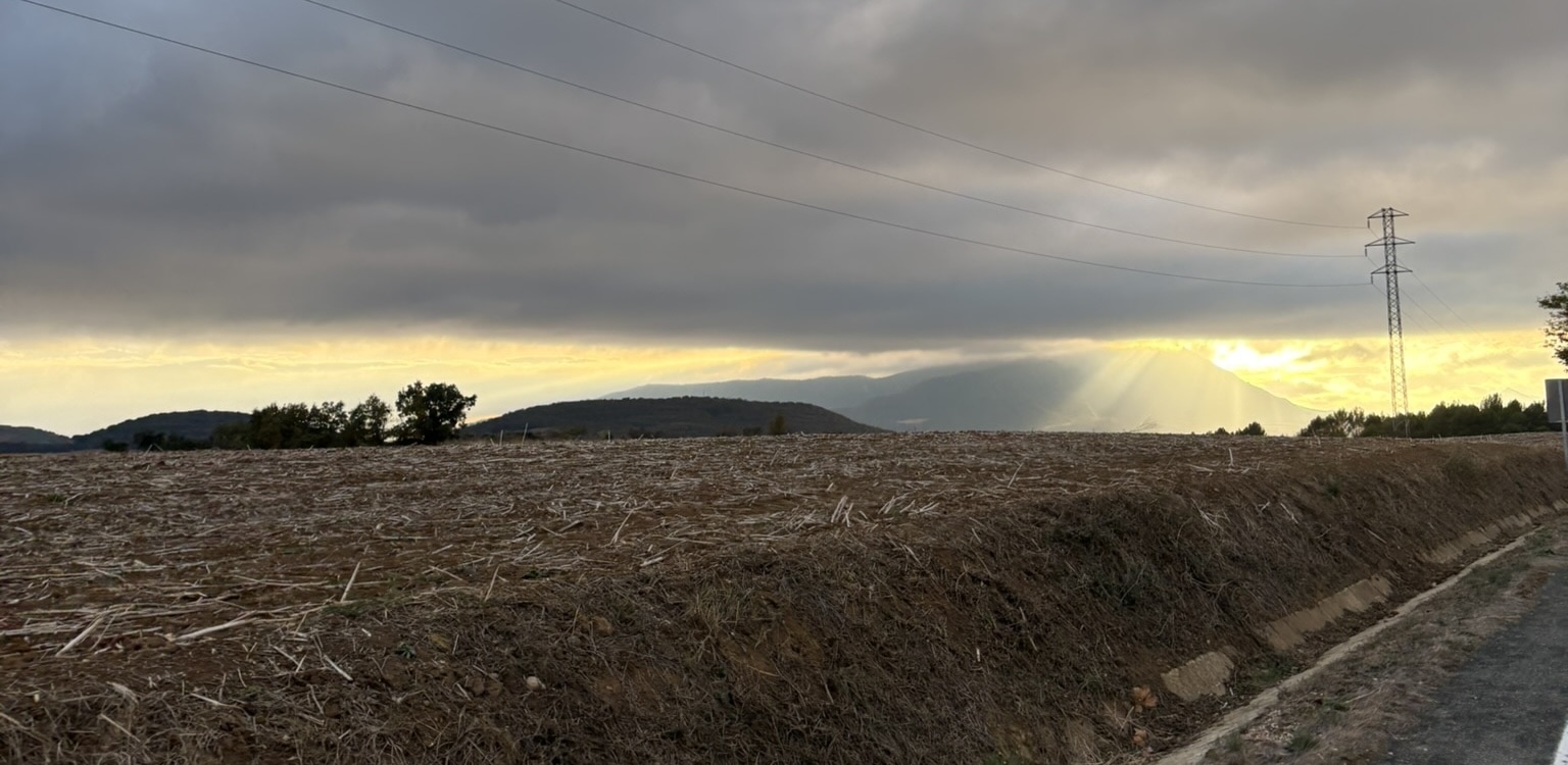
After 35 kilometers of roughly following the river, we start what will be the theme for the entire trip: climbing. Spain is a very hilly country, and while there are no big mountains in this part, there are plenty of rolling hills that you need to go up and down. The climbs are never very steep, usually between 3 and 6%, but that of course means they last longer.
This first set of climbs is me entering the Sierra Norte de Sevilla natural park. Interestingly, I thought that “Sierra” meant a mountain range, but I think it more means the edge of a mountain plateau. Sevilla itself is at about 20 meters above sea level, while the highest point in this park is about 900 meters. The areas after the climb however aren’t low like Sevilla, but rather around 300-600 meters above sea level.
Due to the fact that almost nobody (only three people) have done the 100km segment from Sevilla to Azuaga on Strava, I somehow get the KOM here. I think I’ll count that as a personal record.
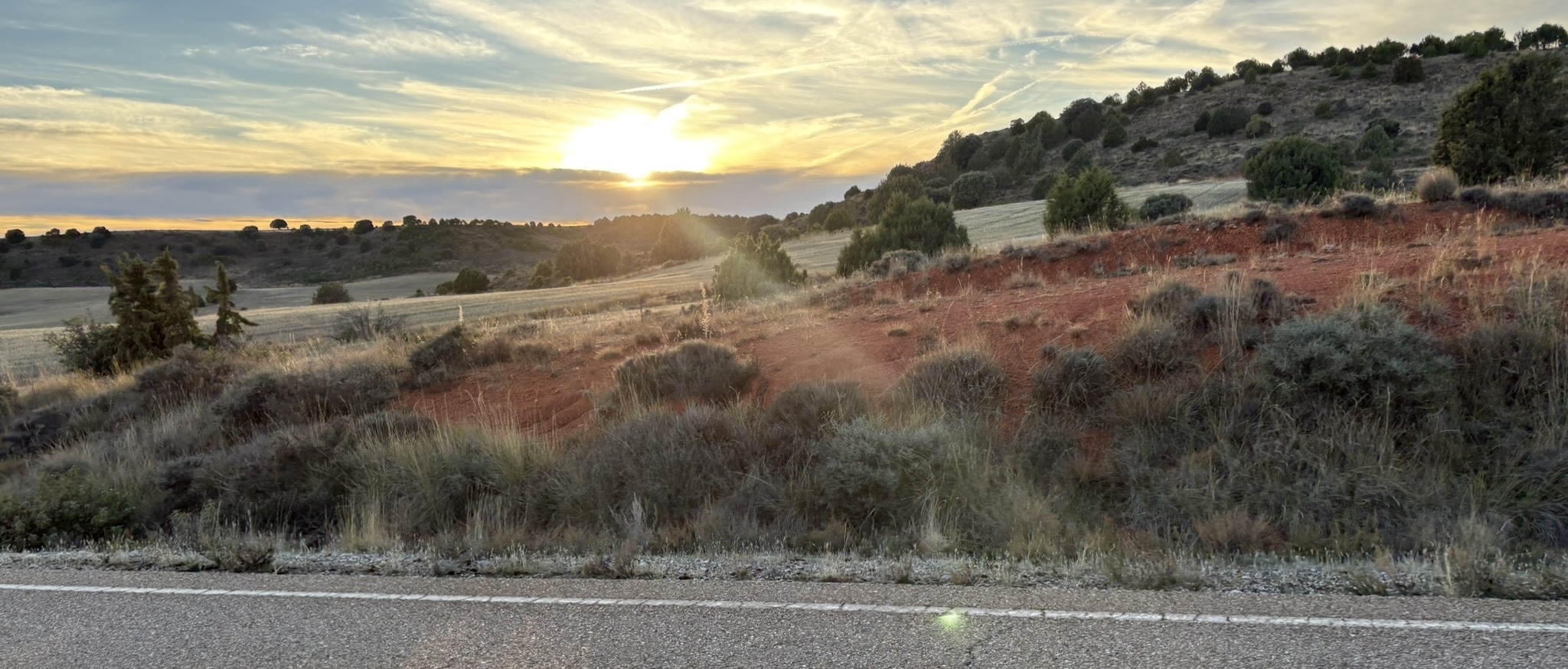
After this, the landscape changes to have a distinctive red soil, with cork oak trees and olive trees. Along the way I stop at a vending machine as I don’t see any open bars, and I get a weird energy drink. Unfortunately it hardly has any sugars! A bit later I also pass some reservoirs which make for stunning views.
The sun is setting as I approach the hotel I stayed at, just outside Navalvillar de la Pela. It’s called Hotel Don Juan, which is a simple roadside hotel with a restaurant and bar. The food is simple but good, and the room is comfortable enough to get a good night’s sleep. For dinner I have a squid a la plancha, as we’re still just close enough to the coast to have fresh seafood.
This first day was about 250 kilometers with 3000 meters of climbing, a rate I’ll aim to keep for the rest of the trip.
Day 2: Extremadura to Madrid
This morning also starts on time with an included breakfast at the hotel. It is some bread with local jamón (delicious), some orange juice, and coffee. After packing up, I get greeted by a beautiful sunrise as I go on my way again.
The first direction of the day is towards Guadalupe. This is known for the monastery which has a famous “black mary” statue. First I have to climb up towards the views of the steep Sierra de Villuercas range. Climbing is pretty steady, so all is good. I am however thanking past me for the decision to go mostly through the gaps in the mountains, rather than going over all the peaks here as I originally considered.
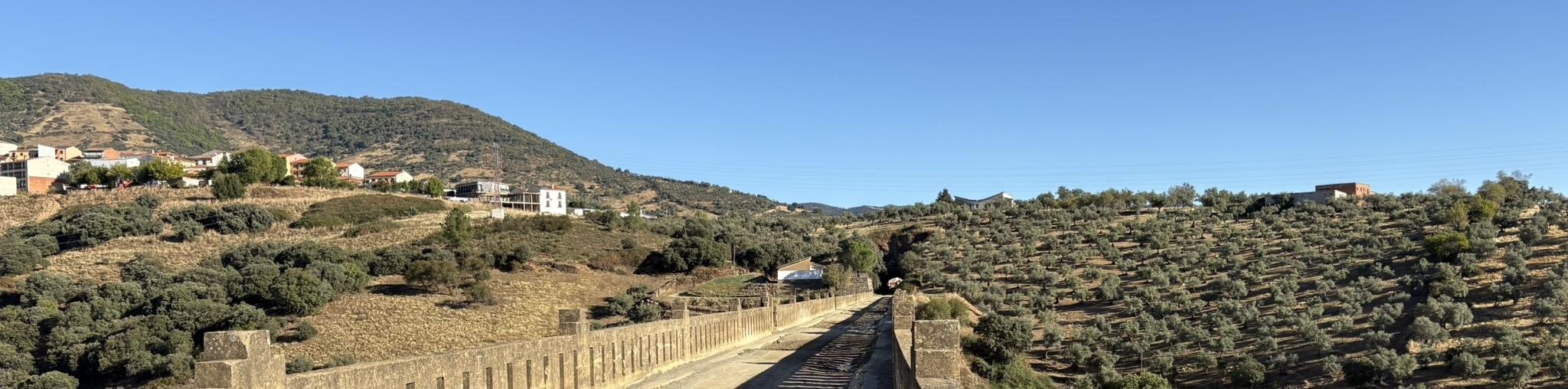
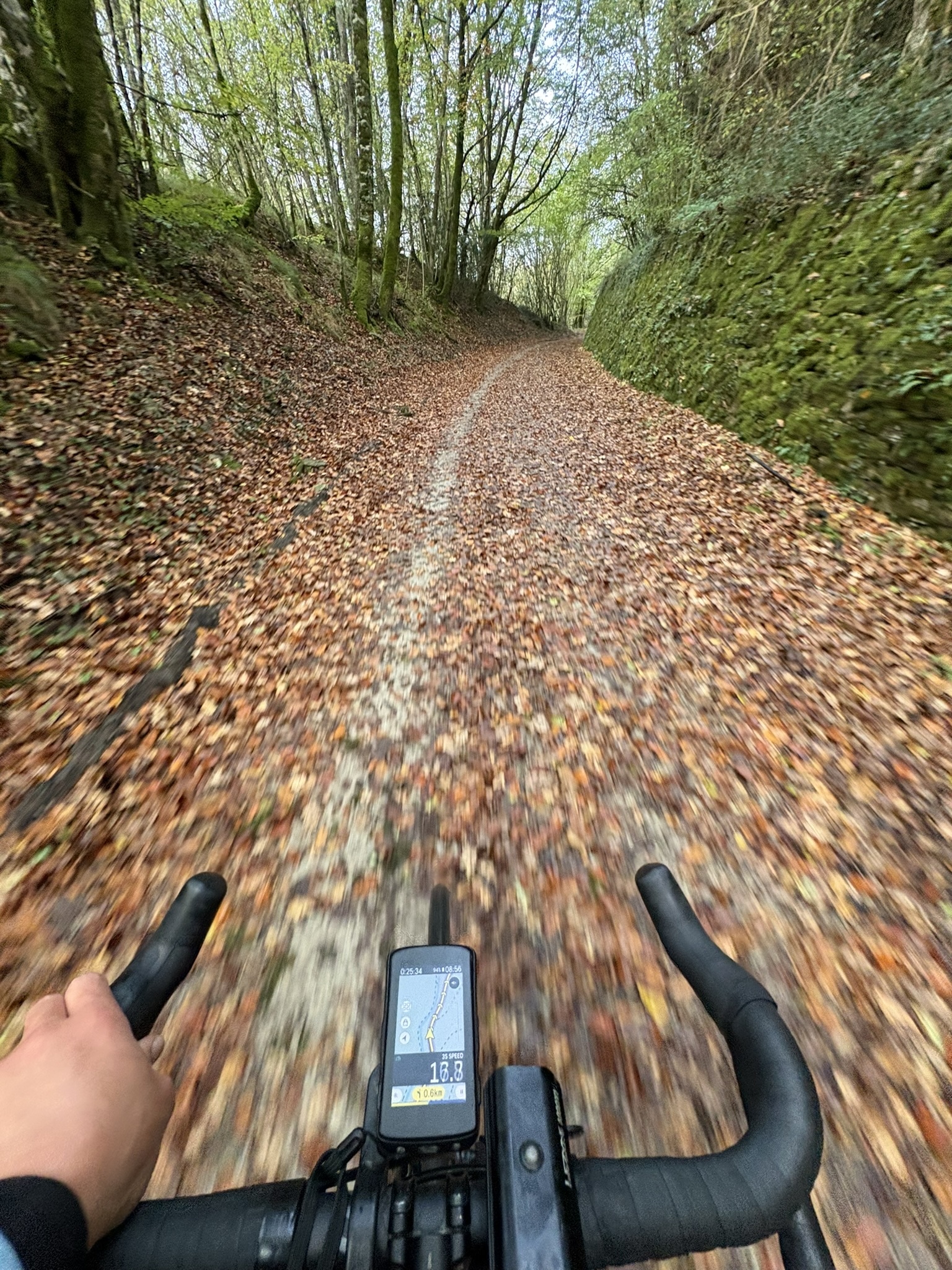
Right before reaching Guadalupe itself I take my first diversion from the road to join the old train line that used to be here. At this point it’s mostly gravel and dirt, but it does feature a couple surprising tunnels and a stunning viaduct over a deep gorge. Definitely worth the different surface as it turns the steep climb into Guadalupe into a more mellow version.
Once arrived in Guadalupe, I look at the monastery from the outside, as well as take a quick stop in a shop to get a top up of drinks and snacks. I also spot a post office that (fairly surprisingly) is open at this time of the day, so I can buy postage stamps for the challenge. Unfortunately they don’t have real stamps, so stickers will have to do.
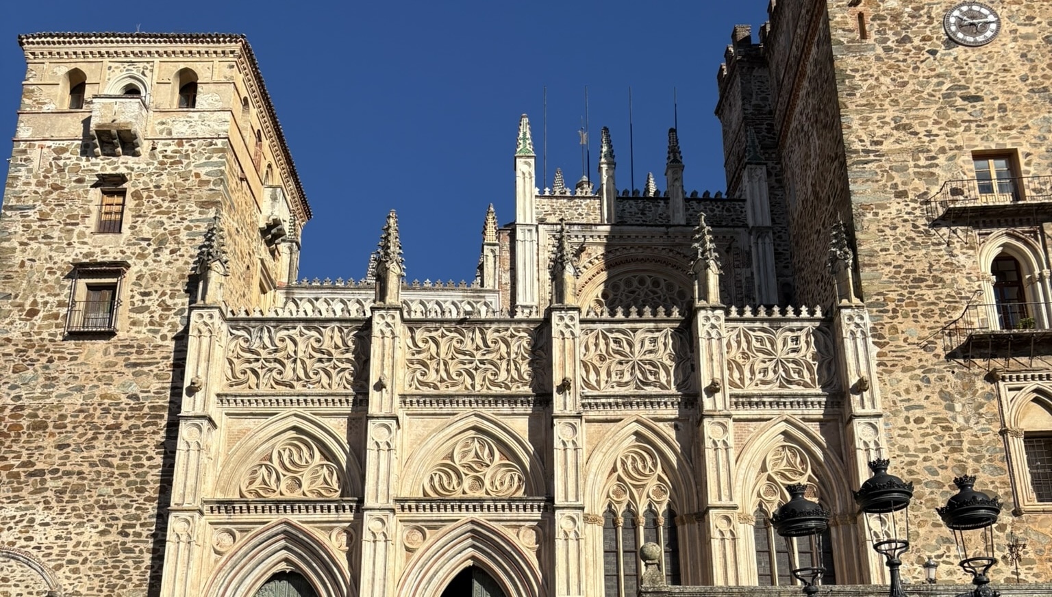
It is from Guadalupe that many conquistadores set off to wreck havoc in the Americas. Hernán Cortés, Francisco Pizarro and Vasco Núñez de Balboa all made a stop here to pray before their expeditions. The monastery became very wealthy thanks to the treasures that were brought back from the New World. The name of the city likely comes from the Arabic “wadi al-lub”, meaning “river of the wolf”, but that’s disputed.
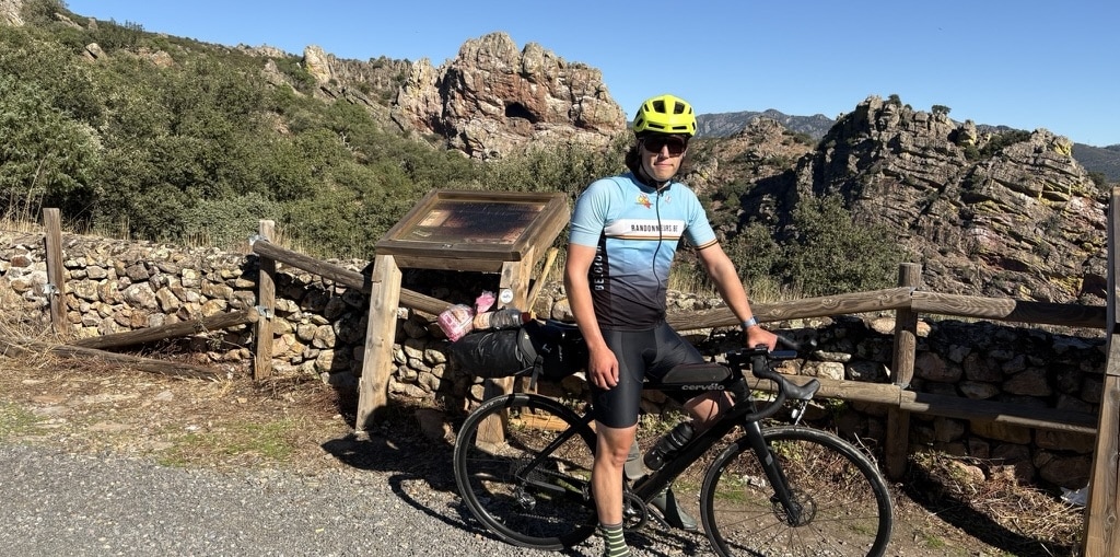
In the ride out of the town, I notice a sharp feeling in my shoe, and take out a little thorn without stopping. I don’t know how it got there, but it’s at least better to have a thorn in your shoe than in the tyre. The views here are stunning, with steep cliffs and rock formations all around.
There are massive groups of vultures making use of the thermals to fly effortlessly high up. This is a really incredible sight, seeing dozens of them circling high up in the sky.
At one of the peaks, I achieve another challenge, which is to get a stranger to take a photo of me. I ask someone in a campervan to take a photo of me at the viewpoint with incredibly broken Spanish, which of course they do. Once I get going again I notice they’re actually French, so I could have asked it without sounding like a toddler, but that’s part of the fun.
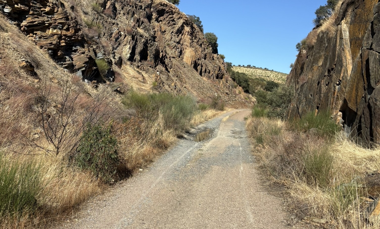
Once the main mountain range is over and I enter the Castilla la Mancha region, I rejoin this same old train line. However, it’s now called the Via Verde de la Jara. It’s technically closed according to the website. I don’t really see why they did that, as it’s perfectly rideable, despite it mostly being broken asphalt and gravel. I guess you need to be careful of the potholes though. Again, this looks really beautiful here, with bridges and tunnels along the way to keep it all interesting.
In the end I follow this path for 30 kilometers, which is almost the entire thing. I only missed the beginning as it started at a dead end, and I wasn’t going to do an entire detour just to get 100% on the (what I in advance only knew as closed and forbidden to enter) Via Verde de la Jara. The path ends at the train station of Calera y Chozas, where I rejoin the regular roads. These are pretty busy as it’s the main road to Talavera de la Reina, but there is a wide shoulder so it’s not too bad.
In Talavera I spot the old city walls as well as the Puente de Santa Catalina, a Roman bridge, that was reconnected many times over the centuries. Unfortunately in March of this year, storm Martinho destroyed some of the connections, so it’s not possible to cross it anymore. In a way it’s symbolic, as storms are what originally destroyed the bridge multiple times in the past as well.
Once that passes, it’s a time for a pretty inconsistent 10km, 400 meter climb up into the Sierra de San Vicente. From there onwards we are subsequently in and out of Castilla y León, Castilla la Mancha and the Comunidad de Madrid, as the border between these regions goes right through this area.
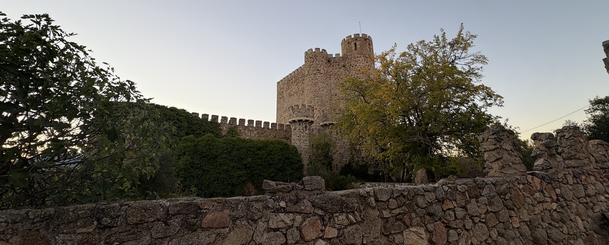
At San Martin de Valdeiglesias, I spot the expected small fortified castle on the hill and see the sun go down. I get ready for the night by getting the reflective vest and lights on, but the temperature is still quite mild now. I leave this town on a gravel descent towards the reservoir. I have to take my time here as my eyes are still adjusting to the dark.
Then comes a following big climb in two parts of 28km long and 700 meters up. The first part is quite stressfull as it’s now completely dark and this is the one road that has no shoulder but very busy traffic. Later the road splits up and I’m no longer on the main direction to Madrid, so the traffic clears up. I am however getting a little stressed as I just found out I can only check in until 22h, which is currently after my ETA.
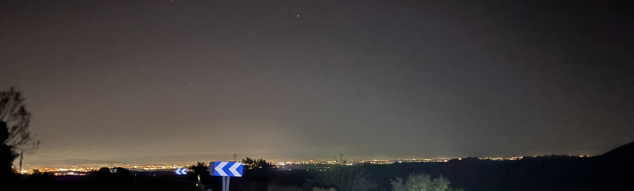
I keep going, and push hard into the beautiful descent where I can see the lights of Madrid in the distance. Once I reach El Escorial, I know I’m getting closer. I have a quick look up close of this monastery as the road was blocked and I had to cross over the plaza that’s surrounding the complex. But this also means that I still have to do the final climb up to the hospederia.
I arrive at the base of the climb, which is also the entrance to the park at 21:09, which is a little earlier than I feared, but I’m not arrived yet. At this point I’m getting very anxious as I don’t want to miss check-in time. I have to explain that I have a reservation to the guard, who doesn’t really understand the spelling of my name or phone number (as I have no idea how to spell in Spanish). He does come out of his guard house and is a little apprehensive letting me still do the climb up, which is still 5 kilometers and 300 meters of climbing, but I tell him I’ve already done 260 kilometers today, so I can handle this in 50 minutes. In the end I do make it in time, arriving as probably the last guest of the day at 21:40. Phew!
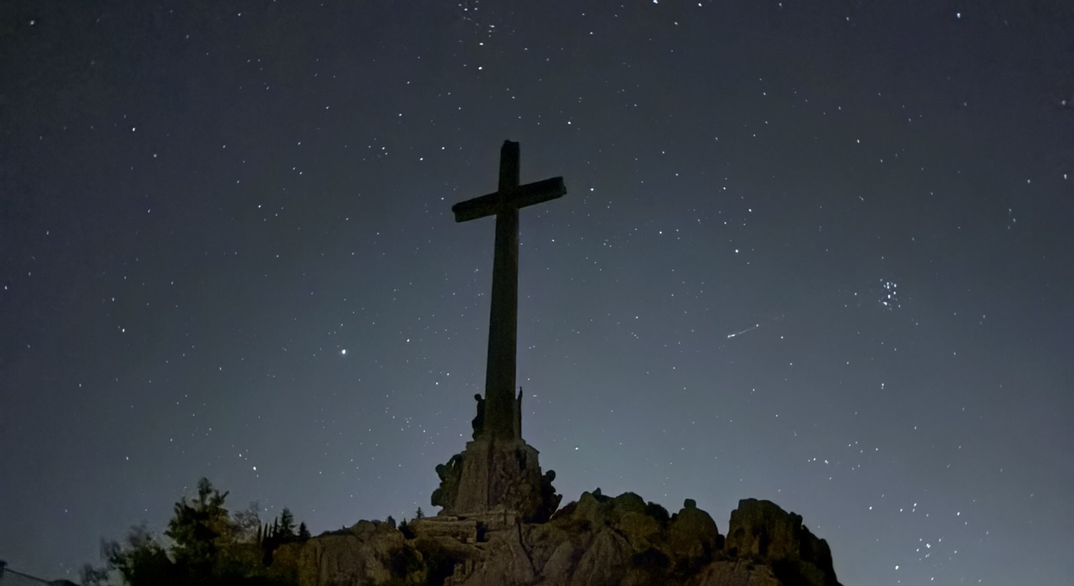
I’m staying at the Hospederia Santa Cruz, which is part of a very controversial place that requires some context. The Valle de Cuelgamuros is now a natural park, but it was originally built as a monument to the Spanish Civil War victory of Franco’s forces. It includes a massive basilica (largest in the world, but cut in half to allow San Pietro in Vatican to stay the largest) and a huge cross (that one is the largest in the world, 120 meters) on top of the mountain, as well functioning as a gigantic mausoleum for the dictator Franco and José Antonio Primo de Rivera, the founder of the Falange party.
This mausoleum has been highly controversial, as it is meant as a glorification of the dictatorship and the civil war. On top of that, the entire site has been built using forced labor of political prisoners, which makes it even more problematic. There are many graves from both sides of the civil war here, but many of the republican side were moved here without the consent of their families, who often don’t even know where their relatives are buried.
There have been multiple attempts to remove the bodies and repurpose the site. In 2019, the Spanish government finally decided to exhume Franco’s remains and turn the site into a place of historical memory, removing the connotation of doing a pilgrimage to the site (which obviously I am not doing).
Going here now is a strange experience. This is obviously built in fascist architecture style, with massive stone blocks and huge open spaces. The entire site is very grandiose, meant to impress and intimidate. But, it now also signifies the end of a dark chapter and the chance for Spanish society to move on and give new meaning to these already existing (and beautiful bar the context) sites. Franco and Primo de Rivera have been exhumed, which symbolically removes the core of the fascist message of the site.
I did think very long on if it was a good idea to choose this place for a stay, as I didn’t want to be seen as glorifying the dictatorship. However, I do think that it’s important to confront history and learn from it, rather than trying to erase it. By staying here, I can reflect on the past and the importance of democracy and human rights.
My room has a direct view of the cross, which is quite an imposing sight. After a shower to warm up again, I look out over the starlit sky and the vaguely visible complex below. It’s a surreal experience, being here alone in the dark, surrounded by the weight of history.
This second day was about 270 kilometers with 3600 meters of climbing. Quite a challenging day, but I’m glad I made it in time.
Day 3: Castilla y León
This day starts somewhat later, as the breakfast is only served from 9am and I don’t want to skip it. By the time I get going, it’s already 10am. I start by descending down to the Embalse de Jarosa via a steep gravel road. This is quite fun, although I have to be careful with the loose surface. Once at the bottom, the climb towards the roof of this trip starts.
This is the Puerto de Navacerrada, also featured as the second to last stage in this year’s Vuelta a España. However, they went up to the Bola del Mundo, which is a dead end road with a TV antenna on top. Bola del Mundo means globe, as it’s a reference to the Spanish national TV channel RTVE that owns this antenna and had a globe as logo. I’m going to the actual pass, which is up to 1850 meters above sea level.
I manage this climb steadily and actually achieve it within an hour and a half without stopping. It isn’t overly steep, but I haven’t managed that with every climb so far so it’s an achievement in a way. From this highest point, I’m also entering the Castilla y León region again, which I will be in for most of the day.
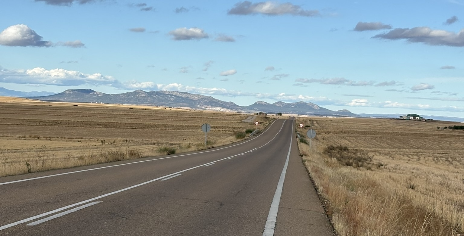
From there starts the longest downhill section of the trip, going down for around 80km. This includes a part of the route that was 50km without a single change in direction, which isn’t an instruction I’ve seen on my GPS before. The views change from mountainous to a plateau which is at around 1000 meters above sea level. Here we start seeing a lot of the wine regions of Ribera del Duero, with fields of vines that now are mostly empty. It’s fascinating to see how some still have the grapes, while others don’t even have leaves anymore. You can also see the abandoned vines that grow just outside of the fields which are left to grow wild and become bushes.
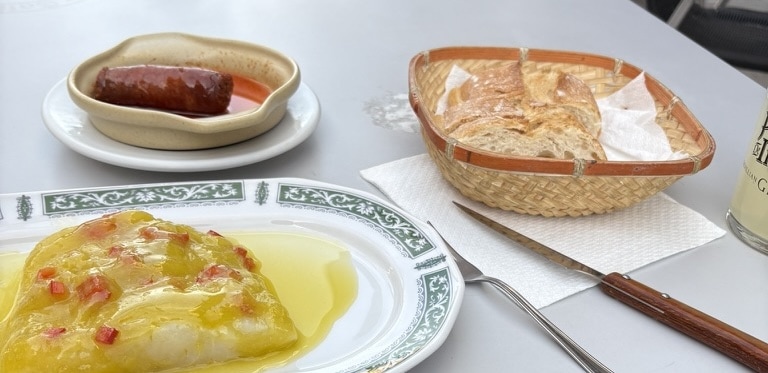
In Aranda de Duero I stop for a snack in a bar, where I have a warm chorizo and a marinated piece of raw cod with olive oil and paprika. Maybe a little bit too much as I can’t really fit in the regular sweets after that, but worth it as it tasted great.
I do a small detour to visit the Roman ruins of Baños de Valdearados. These are the remains of a Roman bath complex, which is quite well preserved. Unfortunately, it’s closed when I arrive, but I can still see through the fence and spot some of the mosaics and structures. Definitely worth a visit if you’re in the area. Maybe go when it’s open though.
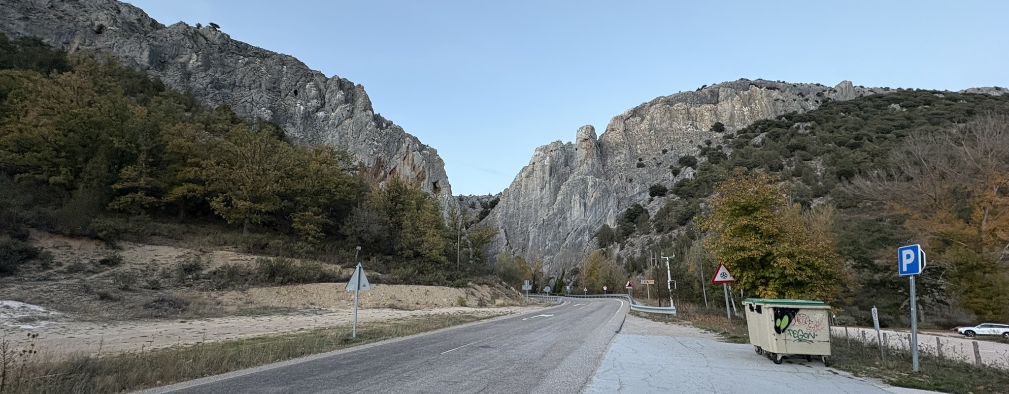
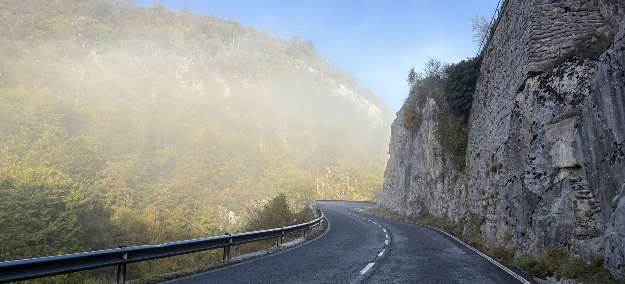
From here on out, the views change again to the hills and mountains of the Sierra de la Demanda. This is probably the most beautiful part of the entire trip, with steep cliffs, including “La Yecla”, a massive rock formation that looks like a giant wall. The road goes up and down here, and gives some stunning views of the surrounding area while the sun is setting. I can still just about make out that I definitely would like to come here again during the day.
I also end up on a surprise gravel road here, just as it’s properly dark. It’s all made up by the people with dogs that I see right at the entrance, which I manage to ask to stroke their little chihuahua. Another challenge completed! After those couple kilometers, it’s back to the paved road again.
After the final twenty kilometers, I arrive in Quintanar de la Sierra, a small town where I stay in the Hostal Domingo (although it isn’t even Sunday). The owner is very friendly and compliments my Spanish, although I doubt she really understood all that I said. As it’s fairly late, and not all the food I had over the day has digested, I skipped dinner and just went to bed soon after.
The third day was about 230 kilometers with 2700 meters of climbing. A bit shorter than the previous days, but still quite a lot of climbing, mainly due to the big climb at the start.
Day 4: to Euskadi
In the morning I try to figure out how to get some post cards. I hadn’t seen any around in shops or post offices, so I ask the owner of the hostal. It takes a while to explain as I have no idea how to say “post card” in Spanish, but eventually we get there. In the end I get some envelopes and paper, as well as an unexplained map of the area. I think that’s because I said “carta”, which means letter in Spanish. By the way, for future reference, “post card” is “tarjeta postal” in Spanish.
It’s a cold and foggy morning as I climb away to Neila and La Rioja. I’m actually getting quite worried that the fog will ruin my “post cards”. I did not see them, but in this area there are many necropolises and burial sites from the middle ages. It would have been a quite steep detour, but at least now I know they exist.
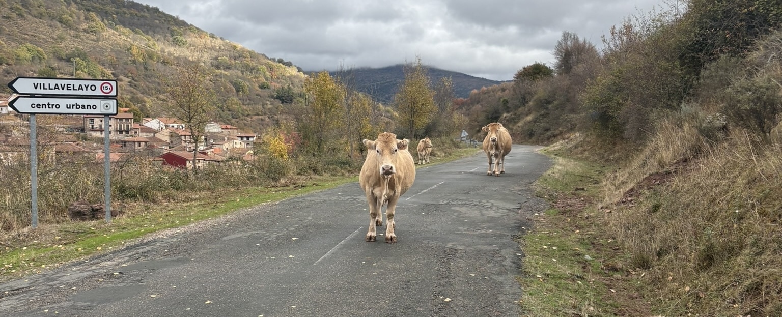
Downhill from Neila, I can immediately tell that I’m in a different region, based only on the road surface now being totally broken. This must be because the rain and winter weather, as well as the narrow road inbetween the hills. What however is the biggest surprise is that I’m seeing quite a few cows just wandering about on the road. This goes on for a couple kilometers, and I have to keep my wits about to avoid startling them too much.
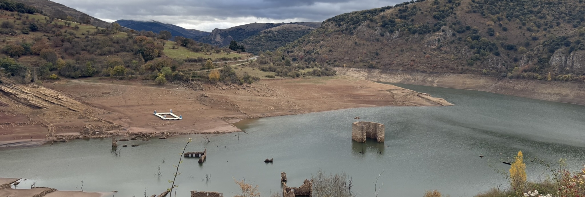
Past this section, I’m riding alongside a very big reservoir, the Embalse de Mansilla. It actually seems to be mostly empty now, probably due to missing rainfall. In the lake you can see the old flooded village of Mansilla de la Sierra, which was abandoned when the reservoir was built. Normally you can just see the tops of some of the taller buildings, but now with the low water level, you can see most of the village. According to the signs, they actually moved the village twice, as they built the reservoir slowly and had to relocate it again when they raised the water level further.
The road then continues onwards until an outskirt of Nájera, where I stop for a snack (small bocadillo with a cod tortilla inside) and to get some more drinks. Here my route joins the Camino de Santiago, but in the opposite direction. This means a bit more gravel next to the motorway mainly in this stretch. The path can be a bit confusing to follow across road crossings, which means I achieved one more challenge of making an accidental wrong turn (down a hill on a busy road). Oops.
This continues until Logroño where I see a surprising bakery slash candy store that allows me to get some sweets for the road. I also finally spot a post box so I can deposit my makeshift post cards.
The next town over is Viana, where I can spot the sign for the twin town in France, La Brède. Another challenge completed! This is also the start of the Navarra/Nafarroa region, so the Basque language is starting to appear on the signs.
At this point however, I start calculating how much time I have left to reach Donostia by the end of the day. It seems quite unlikely that I’ll make it, as my ETA is around midnight, and I have 150 kilometers to go still. I rest for a bit in a bus shelter and decide it’s ok to arrive tomorrow instead of today.
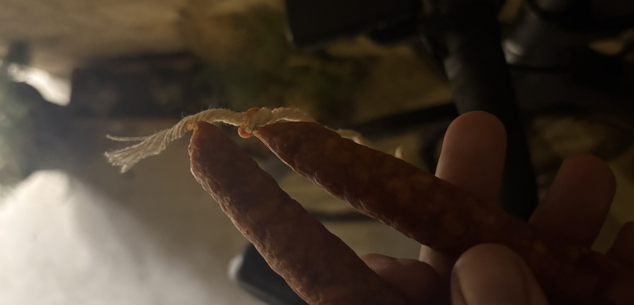
Not too long after I get going again, the sun starts setting, and I also have the feeling I don’t have much to eat left. As by miracle, not long after the last climbing segment I pass by Etxauri, where there is a little grocery store still open. I buy some more candy, a drink as well as a thin chorizo like sausage. It tasted almost buttery which was amazing.
A bit later, in Irurtzun, the final straw for not making it today happens: it starts raining. Not that I’m made of sugar, but today has already been quite long, and I manage to just arrive in a town when it starts pouring down. I have a look on the sheltered town square what my options are. I could try to go on, but that would mean riding another 80 kilometers in the dark and rain, which doesn’t sound very fun. So I decide to stay here for the night, and continue tomorrow.
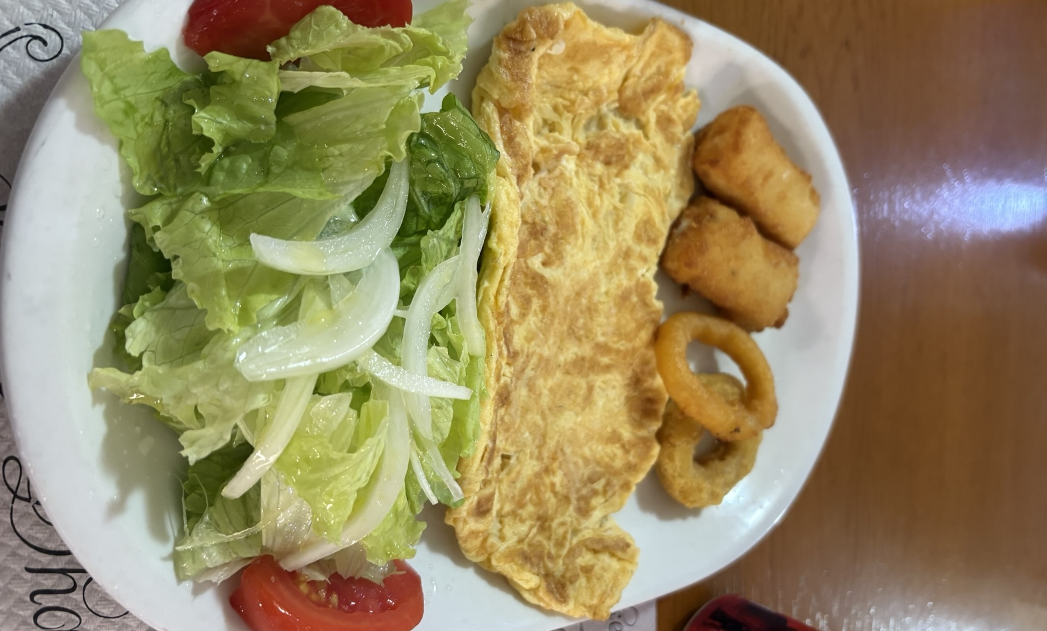
I stay the night at Hostal Machain, which is just before a climb would start. It’s dinner time here, so the owner can not help me check in and I have dinner as well instead of just waiting. It’s a pretty simple dish of tortilla, salad and some croquetas with a cheese sandwich (another one of the challenges) followed by a flan for dessert. After that I get access to the room, which is seemingly in the neighboring apartment building.
This day in the end was about 213 kilometers with also 2300 meters of climbing. Despite feeling like a slower for no real reason, it probably mostly was still because of the hidden climbs and some slower roads.
Day 5: Arrival in Donostia
I leave the hostal in the morning after a simple cream-filled straight donut, and try to thank them in Basque for their hospitality: “Eskerrik asko”. I’m not sure they really understood me, but they smiled so I think it worked.
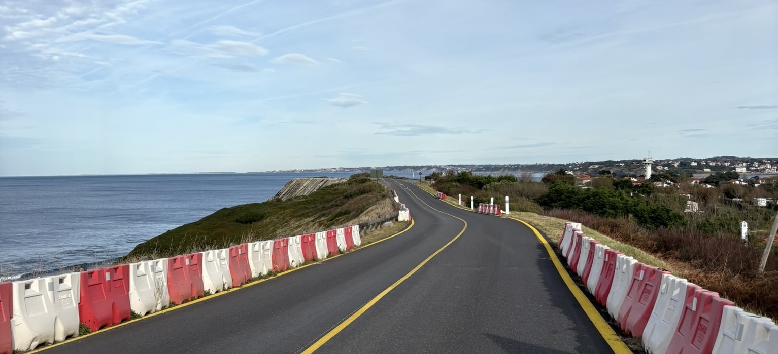
Today I arrive and will finally see Abi again! The rain has cleared up, but it’s still a little chilly and foggy. I get going on the road towards Gipuzkoa, climbing up out of Irurzun. The climb is first steep, but then it becomes less steep once I join the EuroVelo 1/3 again, which goes this direction. This path is gravel however, so I’m going a little slower to make sure I don’t puncture. Once I rejoin the paved road, there’s two final climbs before starting the long descent towards the coast. I’m following a river and am quite surprised I don’t see more people around.
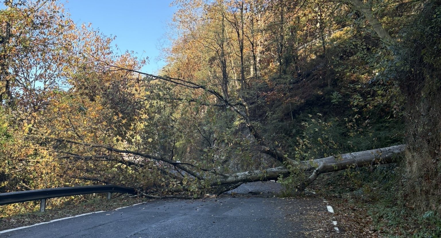
Going across a bridge, a car motions me to slow down, but I don’t really understand why. Continuing on, a couple kilometers later I see what caused the warning, a tree has just fallen across the road. I wait a moment to ensure that it’s safe to traverse, but once I see a group of cyclists (the first group I’m seeing in the entire trip) going the other direction go underneath, I decide to go as well.
Going further down, I see some more groups as well as some people cycling alone. This then makes me achieve one more of the challenges, which is to ride together with another cyclist. I catch up with someone for a bit, but as I don’t know the roads well here and they are a bit slippery, I don’t follow them for long.
That then starts to conclude the trip, once I see more busy traffic going into the city. It gets more dense and industrial first, when I start smelling my first whiffs of the sea. I then pass the train station and turn onto the pedestrian street our hotel is on. I do make it at around noon, a bit earlier than expected.
After freshening up, we spend some time exploring the city together, have some pintxos for lunch and arrange a festive dinner in the evening at a nice restaurant.
This shorter day was 80 kilometers with 1000 meters of climbing. An easy morning to finish the journey to Donostia.
Day 6: Back home
In the morning we head over to explore the city a bit more, visiting the famous La Viña restaurant for some lunch snacks and their famous cheesecake.
Of course, we don’t live in Donostia, so we have to get back home as well. For this, Abi and I take the train from Donostia to Hendaye, and from there the TER To Bayonne. In the mean time, I try to beat her by going that same distance by bike. I manage to do these 57km in just over two hours, which is just minutes slower than the train. She did of course have to wait in Hendaye for the connection, where I surprised her with a kiss, so I technically did overtake her!
We walk around Bayonne a bit, have a drink and attempt to have dinner as well. Unfortunately, most restaurants only seem to open at 19h, which we think is too close to the train departure at 21h, so we just get some sandwiches with both local and Spanish delicacies. After that, it’s the night train back to Paris, which arrives the next morning.
The trip in numbers
- Days cycling: 6
- Total distance: 1 099 km
- Total elevation: 13 915 m
- Total moving time: 44h 58m
- Average speed: 24.4 km/h
- Average heart rate: 98 bpm
- Maximum heart rate: 164 bpm
- Total calories burned: 36 984 kcal
Equipment
My bike is a regular road/gravel bike, with 28/30mm tyres. Currently those are Continental GP5000 (tube type). This works well for the paved roads and light gravel roads I took. There are no mounts for racks, so I used a light bikepacking setup as I’ve used before. A nice surprise on this trip is that I didn’t puncture a single time, despite some rough roads and gravel sections. That’s quite a surprise knowing that these tyres have already done 8000 kilometers and usually puncture more frequently.
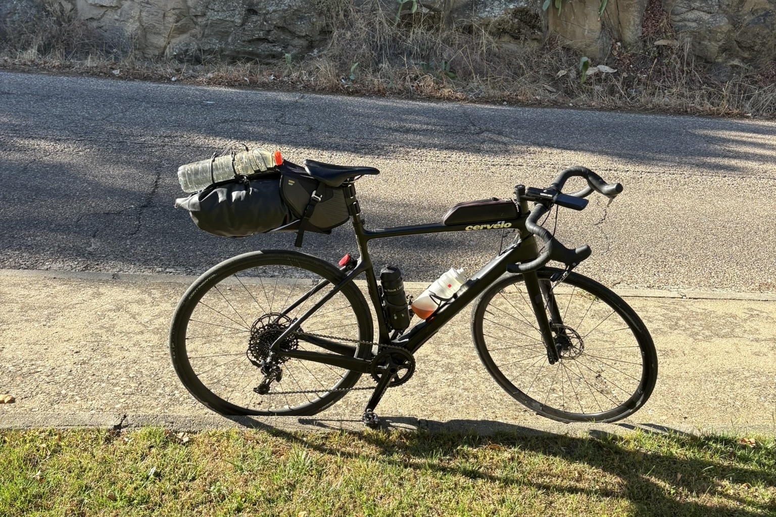
As I stayed in hotels along the way, I didn’t need to bring camping equipment, which saved a lot of weight and space. Because of this, I could fit all my equipment in a single saddle bag (this system from Decathlon with this bag), which is a fairly reliable and comfortable system. Unlike the reputation, I don’t find that this “seat rocket” wobbles a lot, as long as you keep the straps tight and put the bag deep enough in the harness.
For clothing I took two bib shorts, one jersey, a light rain jacket, some socks. I also took a long set of bibs and jersey and gloves, but I didn’t end up wearing those. I didn’t take any normal clothes, as that would take up too much space. I did take a synthetic down jacket in case it got very cold, but I also didn’t end up using that.
For first-aid and toiletries I took some medicine, solid tooth paste, a tooth brush, sun screen, and some chamois cream. I also took a mini-pump, three spare tubes, a tyre lever, and a patch kit.
I took two bidons of 750ml each, as well as an extra regular water 1l plastic bottle to refill if I didn’t find anywhere to fill up or buy drinks. This ended up being quite useful as there were some long sections without seeing any towns or shops.
For the train to Sevilla, a bike bag is needed to pack the bike, I have one from Decathlon that works well, although you’ll always have to be careful with the bike when packed like that, as it’s not very well protected. I didn’t take this bag with me on the trip itself, only for the train ride.
What did I learn?
You can do long distances many days in a row, if you plan well and listen to your body.
Doing many long days in a row means that your performance will likely drop a bit each day, so don’t plan to do extra long days at the end.
Know what you are visiting. Places are much more interesting if you look up some history in advance, as you can then learn more when you see it.
Spain is very mountainous, when you see the elevation numbers, trust them, there will be more climbing than you expect.
Allow for changes in the schedule. When you do such a long trip, you’ll want an extra day or two at the end to allow you to bail or shorten a day if needed.
Know where you will stay each night in remote areas. This avoids needing to contact the places when you are busy riding.
Packing light can be key for comfort. You might be tempted to bring a lot of things that just stay inside your bag without use.
Carry and refill your water and candy frequently enough. Make use of the opportunities you see, as there are long empty stretches.
Allow for some extra time to stop here and there. This means you’ll feel less rushed and will be able to take in the sights where you want.
Giving yourself a couple small challenges to focus on outside of the cycling will give you the opportunity to pay more attention to what you’re seeing.
Always be learning. You don’t get opportunities every day to practice a hobby that takes a lot of time, so reflecting afterwards will give you a better time when you do it again.
How did I prepare?
Earlier this year I did the Race Across Paris event, which is a 1000 kilometer ride starting and ending in Chantilly, going in a figure eight around the north of the country. Doing this gave me the confidence to know that I can do long distances, but that riding overnight is not what I enjoy the most.
Originally I had planned to do this ride in ultra-mode as well, without preplanned stops. However once I surveyed the route in detail, I realized that there are far less options for accomodation than I expected based on my experience in France. Because of this, I decided to book the hotels in advance, however I did not pay for them in advance to keep the plans flexible.
Two weeks before the trip, I did a test ride, which I planned to do 777 kilometers at once, going to Dieppe, following the coast and returning south of the Seine. In many ways this was a complete disaster. My freehub stopped working basically right after starting, which means I couldn’t coast, and the moment I stopped pedaling, the chain would fall off. I had to go back and find an alternative solution. I ended up going to many different stores to find a replacement wheel that day, getting a little stress that I wouldn’t be able to do that test ride at all. In the end I managed to go to my regular bike store La Roue Liber, which did have one in stock. I swapped that wheel and went home, to give it another try on the saturday.
On that saturday, I rode until Dieppe, where I saw the beautiful cliffs, just before it was getting dark, and then did everything until Le Havre in the dark. I arrived past midnight in a cheap hotel I had booked on the way. I could hardly sleep and tried to wake up at 4am to have enough time to ride back, as now it was sunday and I had work again the day after. It was ice cold in the morning, which completely zapped my energy, so I decided to take the train back instead of riding all the way back. This ended up being a bit of a problem as well, as they were working on all train lines back in the direction of Paris that day. I took a train a little closer, cycled another 50 kilometers and then took the Transilien N from Houdan back to Paris.
That weekend taught me a lot of lessons, but the main one was that missing out on amazing views because it’s dark, and stressing about time, hotel checkins etc. really takes away from the experience. Because of this, I decided to cut a lot of distance, and change the route to be almost an entirely straight line, with prebooked accomodation. This way I could focus on enjoying the ride, rather than stressing while riding.
Of course, I don’t do these rides out of the blue, I also regularly ride medium and long distances in weekends, as well as commuting the 25km to work from time to time. I’ve gradually increased the distances I do at once over the years, so that I can now comfortably do 200+ kilometer days without too much trouble. I remember the first time I rode 100 kilometers, which was a big milestone for me. Now I can do that in an evening after work if I want to.
I plan my routes using Strava’s route planner, as it can show me easily how frequently the roads are being used by other cyclists, and allows me to tweak the route without changing the entire thing. The only downside is that it doesn’t have a builtin way to split the route into daily segments, so I have to first route the entire thing, and then duplicate and split it into days manually. I’ve tried out Ride with GPS as well, as they do have that feature, but I found their routing a little too opinionated, and often doing a small tweak entirely changes the route. Strava’s routing is more predictable in that sense.
Conclusion
Overall, this was an amazing trip that I will remember for a long time. Cycling through the diverse landscapes of Spain, from the dry of Extremadura to the mountains of the Sistema Central and finally to soaring along the Basque coast, was wonderful. I recommend everyone who’s on the fence to just start. Go for a shorter distance, or completely challenge yourself. The world is your oyster!
- Haroen